SS United States Reality Capture - Accuracy and Use Case (Part 2)

Accuracy and use case are the two pillars of every spatial reality capture project. Before collecting a single dataset aboard the SS United States, Beast Code defined both, and that clarity shaped every hardware, software, and survey control decision that followed.

Understanding accuracy requirements and use case are the foundations to all spatial reality capture projects. Without clarity on these two cornerstones, even the best technology cannot guarantee meaningful or reliable results.
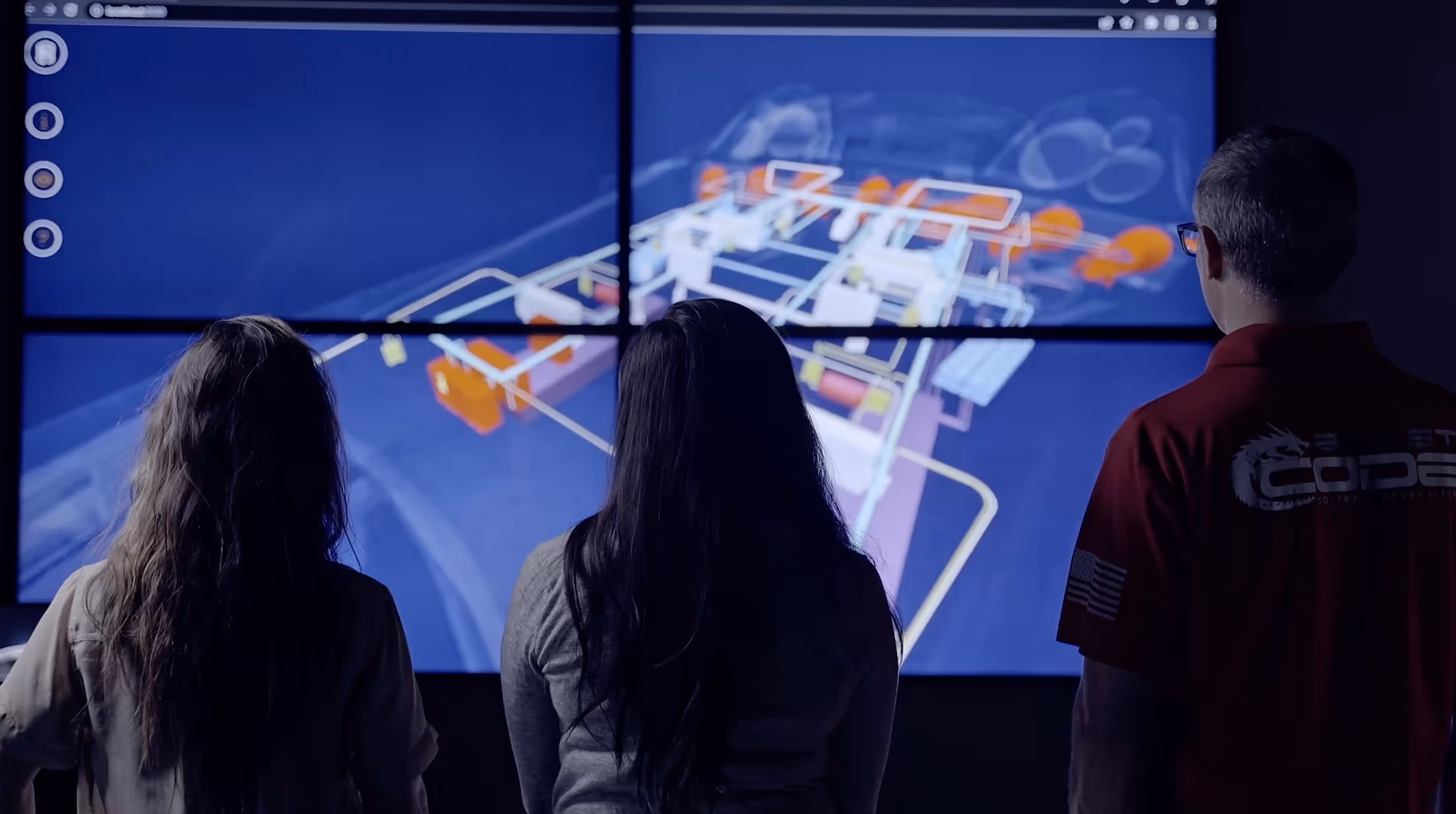
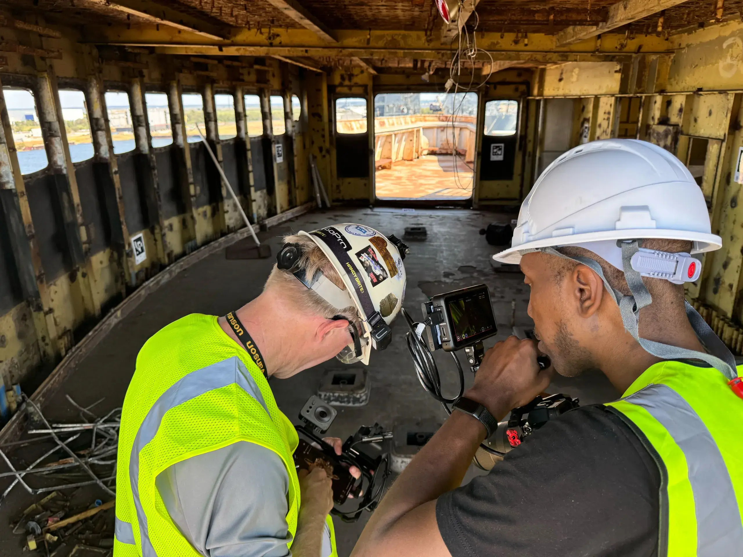
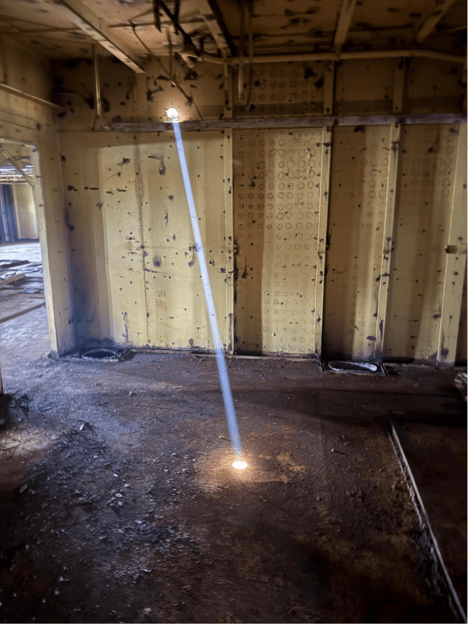
A recent Beast Code project aboard the SS United States illustrates this perfectly. Before collecting a single dataset, we established our accuracy needs, on the order of multiple centimeters, and clearly defined our use case: capture as much of the vessel as possible with our available tools during the two days we had access. With these parameters set, we configured a Global Navigation Satellite System (GNSS) receiver on the bow and tied our XGRIDS L2 Pro into that established survey control. Our drone flights were then aligned to the same control framework. By understanding both accuracy and use case from the outset, we were able to synchronize datasets seamlessly during field capture and make informed decisions about the hardware and software required to support the proof of concept.
A colleague of mine, someone I respect greatly, once told me: "For every reality capture project you must determine two things: Accuracy and Use Case. Start there and it will help you greatly in the long run." Peter Kelsey was absolutely right, and in this article, we will break down why these two pillars truly shape every successful spatial reality capture workflow.
Now let's break this down into the following topics:
- Accuracy Defined
- Use Case, the Why Behind Capturing
- Driving to the Best Decision
- Yes, We Still Need Survey Control
Accuracy Defined
Before any spatial reality capture project can move forward, one question stands above all others: what level of accuracy do you actually need? It sounds simple, 1 centimeter, 1 millimeter, or even 1 micron, but the implications are enormous. This single decision dictates the scale, complexity, and investment required to bring a project from concept to completed deliverable.
Accuracy is the filter through which every other decision must pass. Once the required precision is known, you can begin narrowing down your 3D scanning hardware, selecting appropriate software, and planning your overall field and processing workflows. A project calling for centimeter level accuracy may comfortably rely on UAV photogrammetry or midrange LiDAR, while a millimeter level requirement immediately shifts the conversation toward terrestrial laser scanners, structured light systems, or high precision metrology tools. If the expectation is to reproduce an object so precisely that it is highly faithful to the original, the bar moves again, and so must your equipment, budget, and time allocation.
Understanding accuracy requirements early prevents costly missteps. Overestimating accuracy can lead to unnecessary equipment rentals, extended field time, and bloated budgets. Underestimating accuracy can compromise the entire deliverable, forcing rework or, worse, making the dataset unusable for the intended purpose. Accuracy is not just a technical specification, it is a strategic decision that shapes the entire workflow.
Simply put: determine the accuracy, and the rest of the project's choices will come into focus. It is the first pillar of any reality capture effort, and the one upon which all others depend.
Use Case, the Why Behind Spatial Reality Capturing
If accuracy establishes how precisely we need to capture reality, the use case defines why we are capturing it in the first place. These two pillars work together: accuracy shapes the technical path, while the use case ensures that path leads somewhere meaningful. Without a clearly defined use case, even the most technically accurate dataset risks being directionless, misaligned with project goals, or unnecessarily overengineered.
Before selecting hardware, planning field operations, or investing in software, you need to understand exactly what you are trying to accomplish. Are you building a model for fabrication? For visualization? For planning? For historical preservation? Once the purpose is defined, the correct workflow begins to reveal itself. This was certainly true aboard the SS United States. With only two days aboard and an objective to capture as much of the ship as possible for a proof of concept, our use case set clear boundaries. It told us what mattered most, where to focus our time, and which tools would serve us best. Accuracy helped us choose the right equipment; our use case helped us choose the right approach.
To illustrate the relationship between accuracy and purpose, consider five very different use cases and the accuracy levels each one demands:
- Capturing a pipe on a ship for metal 3D printed fabrication. Requires extreme precision: approximately 0.001 inches (+/-) or about 0.0254 millimeters.
- Documenting a warehouse layout for Building Information Modeling (BIM) and planning. Needs moderate accuracy: about 1/4 inch or roughly 0.6 centimeters.
- Scanning a home for real estate marketing. Prioritizes visual clarity over precision: 1 to 2 inches (2.54 to 5.08 centimeters).
- Surveying a forest to classify vegetation for selective cutting. A broader, landscape scale effort: approximately 2.3 inches (around 6 centimeters).
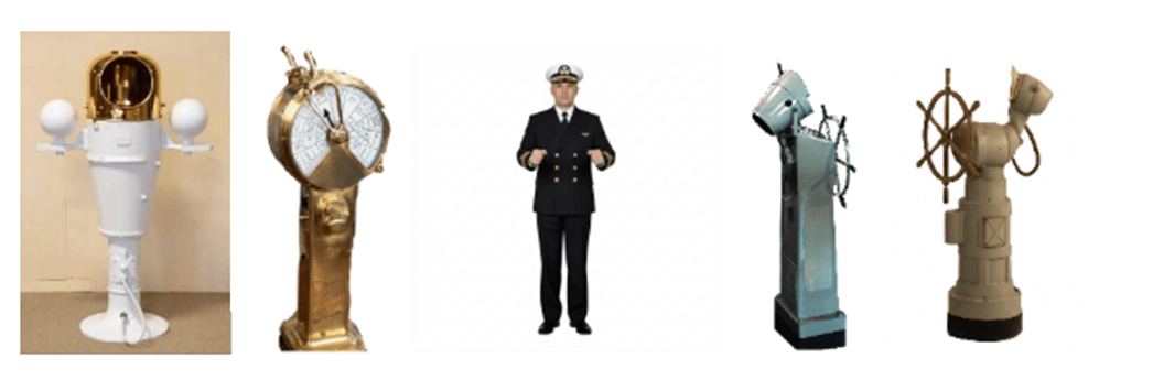
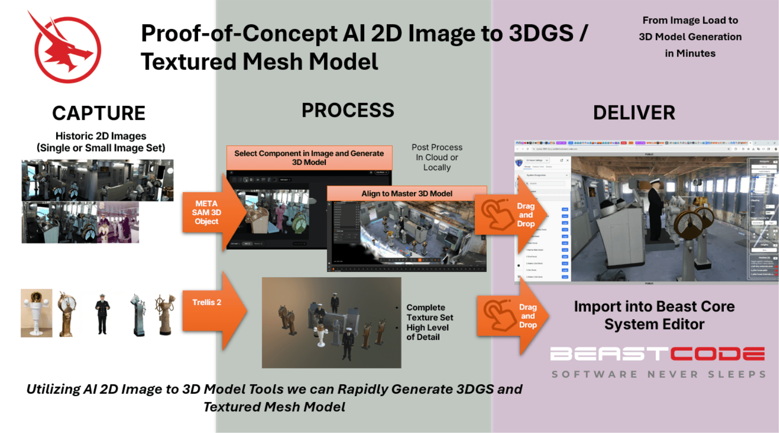
- Creating a 3D representation of the SS United States Pilot House from historical imagery. Focuses on representational fidelity, "inches" level accuracy, rather than exact measurable precision.
These examples reveal an essential truth: the use case doesn't merely influence the required accuracy; it dictates it. A project requiring fabrication cannot tolerate the same leeway as a project meant for visualization or ecological analysis. Conversely, a highly detailed scanner is unnecessary in scenarios where context and scale are more important than exact millimeter accuracy.
When you understand why you are capturing a space, everything else falls into alignment. It becomes easier to choose the right tools, justify the appropriate investment, and design a workflow that is both efficient and purpose built. Use case is not just the second pillar of spatial reality capture, it is the guiding force that gives the entire project direction and clarity.
Driving to the Best Software and Hardware Decision
The landscape of spatial reality capture tools, both hardware and software, is enormous and expanding at a rapid pace. For anyone stepping into a project without a clear understanding of the required accuracy and defined use case, this ecosystem can feel overwhelming. But when you begin with the two foundational questions outlined earlier, how accurate does the data need to be and what am I trying to accomplish, the path forward becomes dramatically simpler. These early decisions act as filters, helping you narrow the field from hundreds of possible solutions down to just a handful that truly align with project needs.
This is exactly why, during our proof of concept work aboard the SS United States, we were able to confidently choose a GNSS receiver, align our XGRIDS L2 Pro to a known control point, and tie our drone flights into the same system. The clarity of our accuracy requirement (multiple centimeter precision) and our use case (capture the ship comprehensively within two days) eliminated guesswork and dictated the right combination of tools. The same logic applies to every spatial reality capture project, regardless of scale or complexity.
To demonstrate how accuracy and use case guide real world decision making, let's revisit the five scenarios introduced earlier and walk through how each one leads naturally to its ideal hardware and software choices:
- Capturing a pipe on a ship for metal 3D printed fabrication. Required accuracy: 0.001 inches (+/-) or 0.0254 mm. This level of precision immediately rules out mobile phones, Simultaneous Localization and Mapping (SLAM) devices, and most terrestrial scanners. You are now in the world of metrology grade tools like the CreoForm Black or similar systems capable of delivering submillimeter accuracy. The environment also becomes part of the decision: tight spaces, limited mobility, and the need for consistent target placement mean you'll likely rely on a laptop based workflow and physically compact equipment. The use case and accuracy requirement together point unambiguously toward high precision handheld metrology scanners.
- Documenting a warehouse for BIM and layout planning. Required accuracy: approximately 1/4 inch or 0.6 cm. At this accuracy level, the options start broad, but scale quickly narrows them down. For very large warehouse footprints, a terrestrial laser scanner becomes the appropriate choice, offering the required precision over long distances. You can also use a higher end walkabout scanner like the NavVis VLX or MLX that advertise around 0.24 to 0.59 inches; the FARO Orbis is similar in accuracy. If the accuracy requirement shifts slightly, into the 1 to 3 cm range, then SLAM based walkabout systems such as the XGRIDS L2 Pro become completely viable. In such cases, an indoor drone photogrammetry workflow could also be justified. The warehouse use case pushes the decision toward solutions that balance accuracy with speed and coverage.
- Scanning a home for online real estate marketing. Required accuracy: 1 to 2 inches (2.54 to 5.08 cm). Here, accuracy requirements are modest, and the emphasis is on usability and visual clarity rather than precision fabrication tolerance. SLAM walkabout solutions like the NavVis product line, FARO Orbis, or XGRIDS systems are ideal, offering fast capture and strong visual outputs. Alternatively, mobile based scanning tools such as Dot3D or PolyCAM can suffice if the goal is mainly rapid visualization with some basic measurement capabilities. The longstanding Matterport system also fits perfectly within this accuracy and use case range. The choice is driven by the simple need for attractive, navigable 3D data rather than strict measurement fidelity.
- Surveying a forest to classify vegetation for selective cutting. Required accuracy: approximately 2.3 inches (around 6 cm). Because the use case covers large geographic areas, aerial capture becomes the immediate and obvious direction. A drone flight combined with photogrammetry software such as Reality Capture is ideal for generating high quality surface models. If vegetation classification is central to the project, hyperspectral or multispectral camera payloads add the necessary analytical depth. The scale and analysis requirements push the solution toward airborne workflows that provide efficient coverage and environmental insight.
- Creating a 3D representation of the SS United States Pilot House from historic imagery. Required accuracy: representational, "inches" level. In this scenario, the use case dominates the decision. Since only historical imagery is available, physically scanning the structure is not possible. Therefore, traditional scanning tools become irrelevant. Instead, the correct path is an AI driven 2D to 3D reconstruction pipeline, capable of generating a representational model based solely on photos. Here, accuracy is interpretive rather than absolute, and the use case dictates the entire methodology.
Across all five examples, the pattern is unmistakable: when you start with accuracy requirements and clearly define the use case, the right hardware and software decisions reveal themselves quickly and confidently. Without these foundational steps, teams often waste time evaluating tools that were never appropriate or pursuing workflows that cannot deliver the desired results.
Beginning every project with these two questions does more than streamline decision making. It ensures that investments are aligned with outcomes, that workflows are efficient, and that the final deliverables genuinely meet their intended purpose.
Yes, We Still Need Survey Control
One of the most common questions in spatial reality capture is, "At what point can I stop defining survey control?" It's an understandable question, especially as scanning devices become more integrated, more automated, and more capable of generating usable data with minimal setup. But the truth is this: survey control is still one of the most important contributors to delivering consistent, accurate, and properly aligned spatial data. Regardless of whether your project requires submillimeter precision or simply a representational model, establishing control will almost always improve your results.
At first glance, it might seem logical that the lower the accuracy requirement, the less you need a control network. After all, even your mobile phone embeds basic GPS information capable of placing a dataset in a world coordinate system with high centimeter or low meter accuracy. But that assumption overlooks a critical point: control isn't just about achieving extreme precision. It's about anchoring your project to a known reference frame, reducing drift, and minimizing the burden of postprocessing alignment.
In fact, the guiding principle is simple: if you have the ability to establish control, you should use it.
When your use case takes place outdoors and you can bring a GNSS receiver or employ precision correction services like RTX, you can lock your entire dataset into world coordinates at low centimeter resolutions. This instantly elevates the reliability of the capture and reduces or eliminates the need to wrestle with misalignments later.
Even in workflows that do not demand high accuracy, such as real estate visualization or large area environmental analysis, control contributes to tighter, cleaner, and more stable datasets. For SLAM based scanners, the benefits are even more pronounced. Introducing tools like AprilTags, checkerboards, or other alignment markers significantly reduces drift and enhances consistency across long or complex capture paths. Dot3D is a strong example of a platform where control points and artificial targets make a measurable difference in the final output.
Our own work aboard the SS United States demonstrated this clearly. By establishing GNSS based control on the bow and tying our XGRIDS L2 Pro and drone flights into that reference, we aligned our datasets in real time while in the field. Because we had both a defined accuracy requirement and a clear use case, using GNSS control was an obvious choice that ultimately shaped the efficiency and quality of the entire proof of concept.
Whether you're capturing a pipe for fabrication, scanning a house for listing photos, mapping a forest canopy, or reconstructing a historic pilot house from imagery, survey control remains a fundamental component of a high quality spatial reality capture workflow. The more control you integrate, the tighter and more reliable your deliverable becomes, and the less time you'll spend correcting issues after the fact.
Simply put: always introduce survey control whenever you can. It's one of the easiest ways to elevate accuracy, reduce drift, and ensure your datasets come together cleanly, no matter what tools you're using or how demanding the project may be.
Conclusions
At the heart of every spatial reality capture project, no matter the industry, scale, or complexity, two questions form the foundation for success: what level of accuracy do you need, and what are you trying to accomplish? These questions may seem simple, but they shape the entire trajectory of a project. They determine the hardware and software you select, guide how you capture data in the field, influence the efficiency of your workflow, and ultimately define whether your deliverables meet mission critical expectations.
Our work aboard the SS United States reinforced this truth. Because our accuracy requirements and use case were clear from the outset, we could confidently establish GNSS control, deploy the XGRIDS L2 Pro in alignment with that control, and integrate drone based photogrammetry in real time. The result was a streamlined workflow and fully aligned datasets captured efficiently under tight time constraints, an outcome made possible by following this foundational decision making process.
These same principles extend across all the example scenarios explored throughout this article. Whether the goal is submillimeter fabrication, warehouse BIM planning, real estate visualization, forestry analysis, or reconstructing a historic pilot house from archival imagery, the correct workflow only emerges after accuracy and use case are defined. Everything else, tools, techniques, time investment, budget, and team workflow, flows naturally from those decisions.
And throughout the entire process, survey control remains as critical as ever. From GNSS and RTX solutions to AprilTags and artificial targets, establishing control strengthens alignment, reduces drift, and minimizes rework, regardless of whether your accuracy requirement is in millimeters or centimeters.
This foundational approach aligns directly with Beast Code's mission to create unified, accurate, and intelligent digital ecosystems that empower decision makers across defense, industry, and enterprise applications. Beast Code's vision is built on the belief that digital twins, simulation environments, and interoperable data ecosystems must be anchored in reality, and anchored correctly. By prioritizing accuracy requirements and use case definition, teams can produce data that seamlessly feeds Beast Code's platforms, enabling everything from training and sustainment to predictive analytics and large scale system integration.
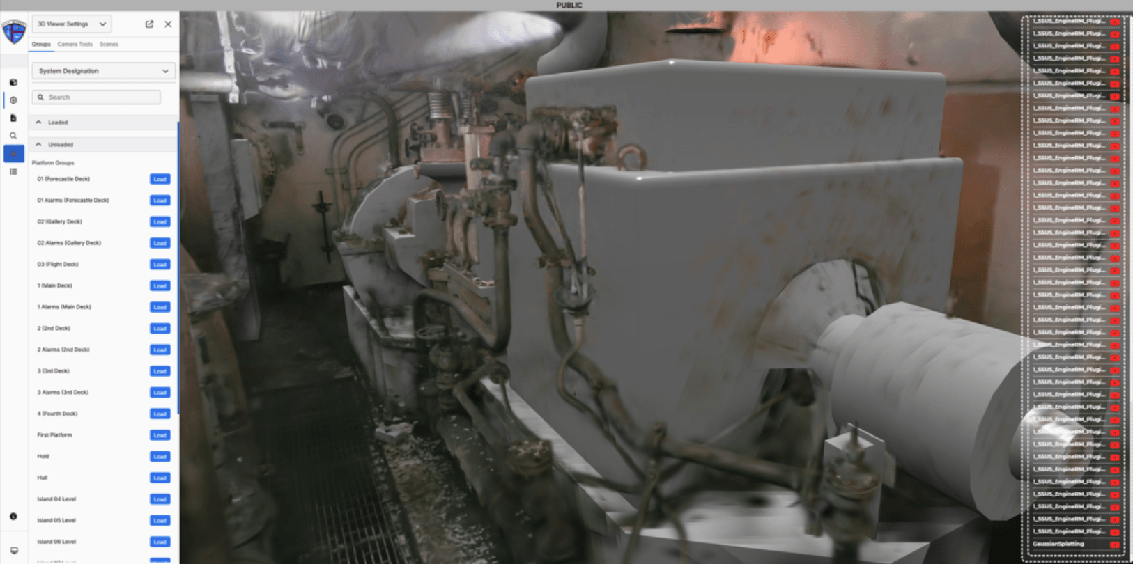
Beast Code's solutions rely on clarity, consistency, and interoperability. Starting every project by defining accuracy and use case ensures that spatial reality capture data integrates cleanly into Beast Core, supports the development of high fidelity digital twins, and enhances the real time operational insight that Beast Code's ecosystem is designed to deliver.
In the end, the rule remains simple, but its impact is profound: determine your accuracy requirements and use case first, and every other decision becomes clearer, more efficient, and more aligned with your project's goals. It saves time, reduces unnecessary investment, improves data quality, and creates a strong foundation for the advanced digital solutions that organizations like Beast Code build to transform how people train, plan, execute, and innovate.
Stay tuned for Part Three: The Changing Landscape of Reality Capture, where we explore how rapid advances in spatially aware AI, pocket sized capture devices, and new 2D to 3D pipelines are reshaping the future of spatial reality capture, opening up new workflows, lowering barriers, and ushering in an era where spatial understanding becomes native to nearly every device and application.
Did you miss part one of our Reality Capture series?? Want to catch up?? Click here
Want to integrate today and see how our solutions can support you and your team? Contact us today.
Recent Articles
.jpg)